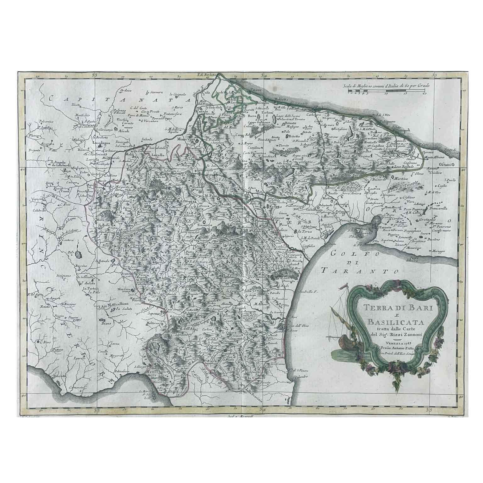
Zatta Antonio Land of Bari and Basilicata Venice 1783. Geographic map taken from the work of the publisher Antonio Zatta, Atlante novissimo, illustrated and augmented with observations and discoveries made by the most celebrated and recent geographers. Published in Venice between 1775 and 1785, engraved in etching and burin. The plates were mainly designed by Giovanni Pitteri and engraved by Giuliano Zuliani with beautiful original coloring. Within the cartouche with a boat and garlands of flowers, the words Land of Bari and Basilicata taken from the maps of Sig.r Rizzi Zannoni Venice 1783 by Antonio Zatta with Privil. of the Exc. Senate. The map clearly marks the town and the watercourses. The sheet has a vertical fold and is in good condition and is provided within a modern frame.
Height: 47 (32) cm. Width: 56 (42) cm.
Art. A1010