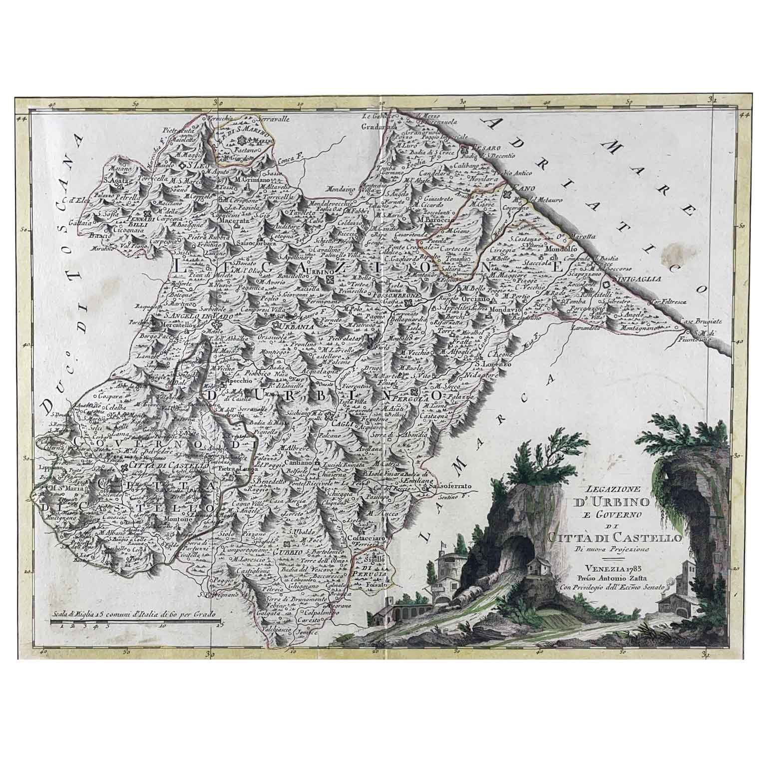
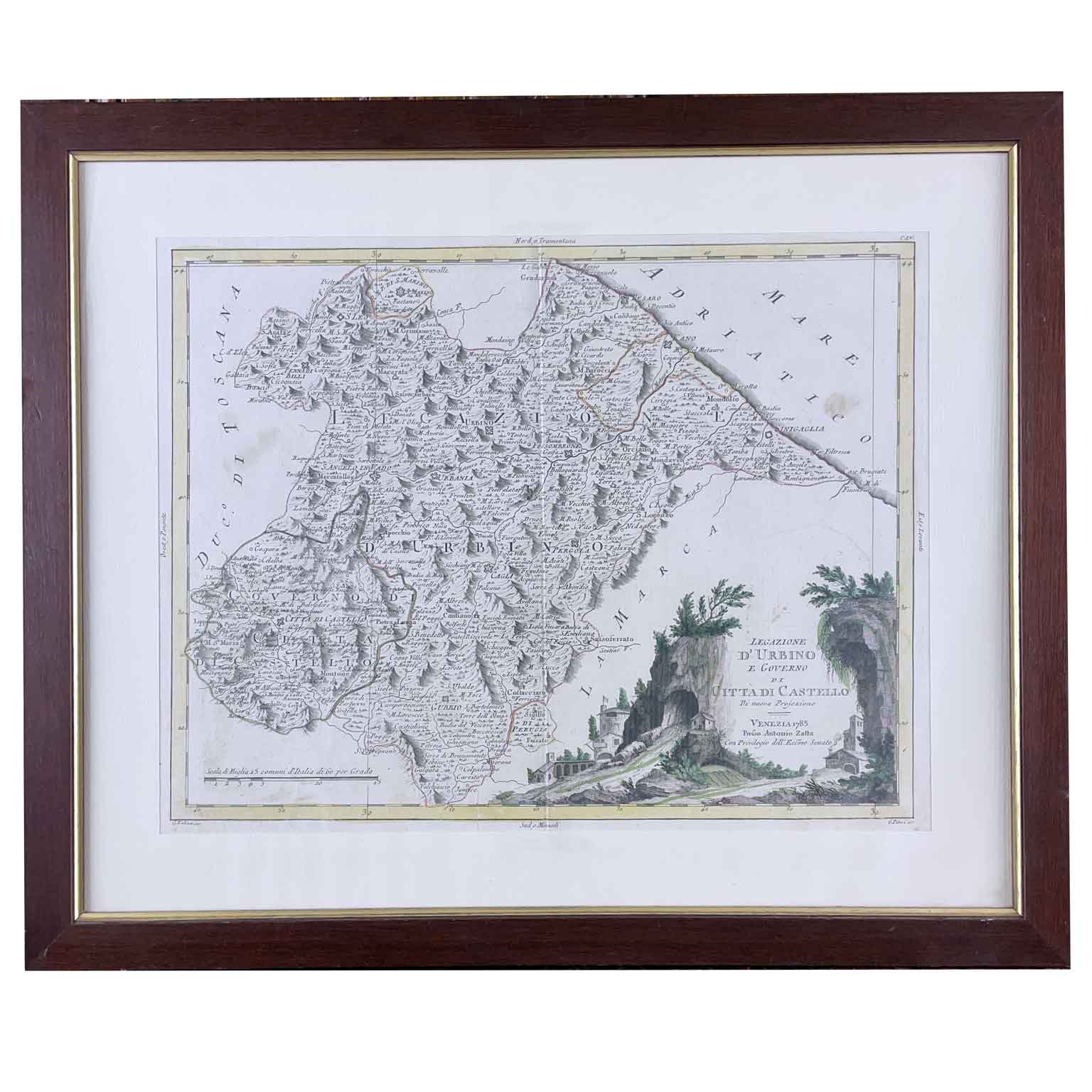
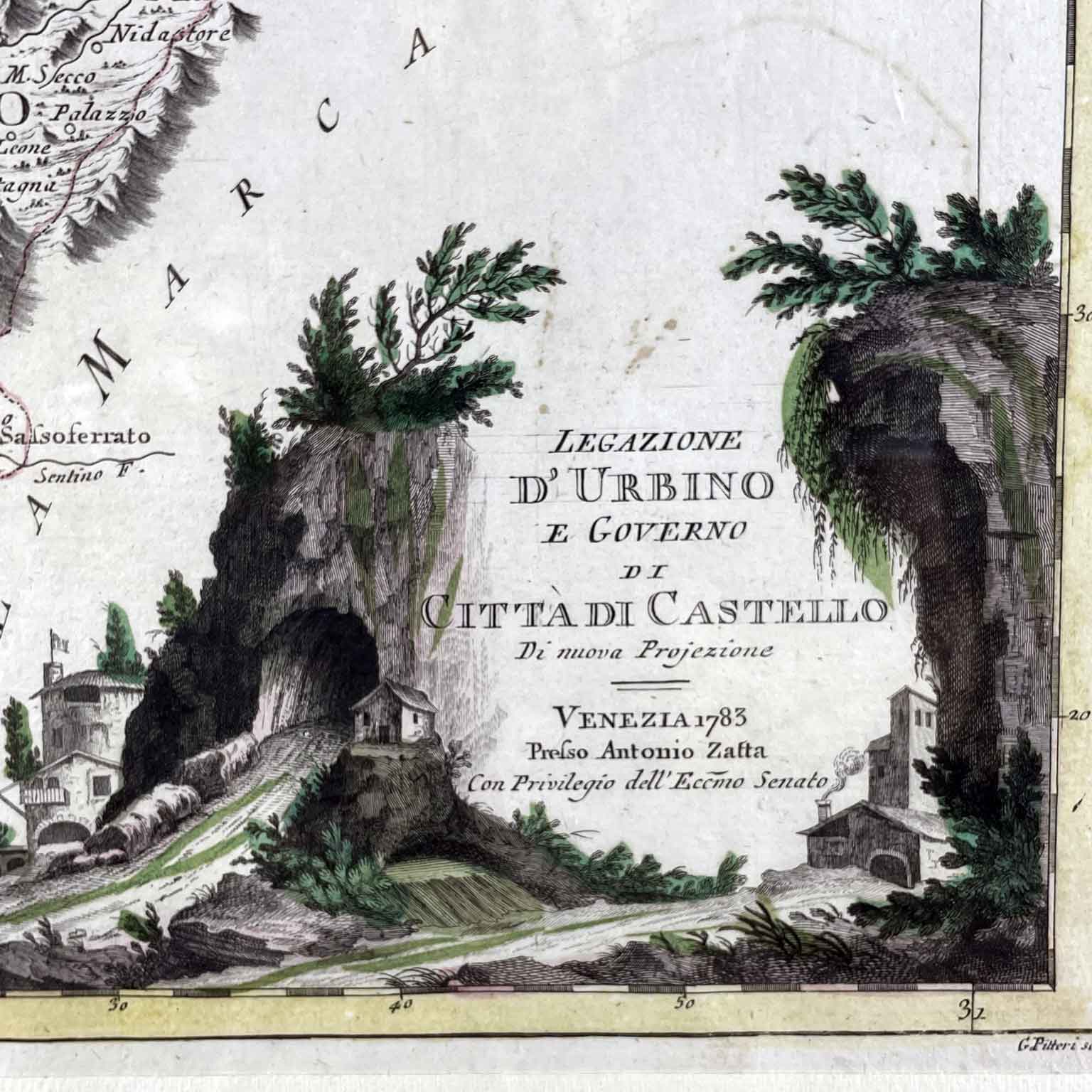
Antonio Zatta Legation of Urbino and Government of Città di Castello Venice 1783 Geographical map taken from the work of the publisher Antonio Zatta, Novissimo Atlas, illustrated and enlarged on the observations and discoveries made by the most famous and most recent geographers. Published in Venice between 1775 and 1785, it was etched in aquatint and burin. The tables were mainly designed by Giovanni Pitteri and engraved by Giuliano Zuliani with beautiful original coloring. Our map bears at the bottom left a beautiful cartouche formed by a landscape that imagines the Furlo gorge crossed in a gallery by the Via Flaminia with some buildings, perhaps inns and military forts, all wonderfully colored in the period. The map indicates only the territories affected by the legend, thus making it particularly clear and readable; the Apennine reliefs are indicated in a didactic way through the grouping of the only peaks which, having a shaded side, give the map a good depth. The map is in good condition with a central fold and a small stain on the Adriatic Sea and has a modern frame. Measurements Height: 56 (43) cm Width: 47 (33.5) cm art. A1006