English
Italiano
Español
Deutsch
Français
Português
Login
Login Espositori
English
Italiano
Español
Deutsch
Français
Português
Login
Exhibitors Login
Categories
Categories
🆕
View all the latest items
19th century paintings
20th century paintings
Antique Ceramics
Antique Fireplaces
Antique Frames
Antique Furniture
Antique objects
Antique prints
Antique silver
Archaeology
Art Déco
Bijoux
Carpets
Chandeliers
Clocks and watches
Collectibles
Contemporary art
Doors
Earthenware
Globes and geography
Icons
Irons and antique tools
Ivories and Jades
Jewellery
Lamps
Liberty
Midcentury and Design
Militaria
Objects of art made of glass
Old master drawings
Old Master Paintings
Oriental antiques
Rare Books
Recovery architecture
Scientific instruments
Sculptures
Textiles
Vintage Cars & Vehicles
Vintage, Fashion and Accessories
EXHIBITORS
BLOG
SEARCH OR SELL
BECOME EXHIBITOR
🆕 View all the latest items
19th century paintings
20th century paintings
Antique Ceramics
Antique Fireplaces
Antique Frames
Antique Furniture
Antique objects
Antique prints
Antique silver
Archaeology
Art Déco
Bijoux
Carpets
Chandeliers
Clocks and watches
Collectibles
Contemporary art
Doors
Earthenware
Globes and geography
Icons
Irons and antique tools
Ivories and Jades
Jewellery
Lamps
Liberty
Midcentury and Design
Militaria
Objects of art made of glass
Old master drawings
Old Master Paintings
Oriental antiques
Rare Books
Recovery architecture
Scientific instruments
Sculptures
Textiles
Vintage Cars & Vehicles
Vintage, Fashion and Accessories
EXHIBITORS
BLOG
SEARCH OR SELL
BECOME EXHIBITOR
Exhibitors Login
Apertura ricerca...
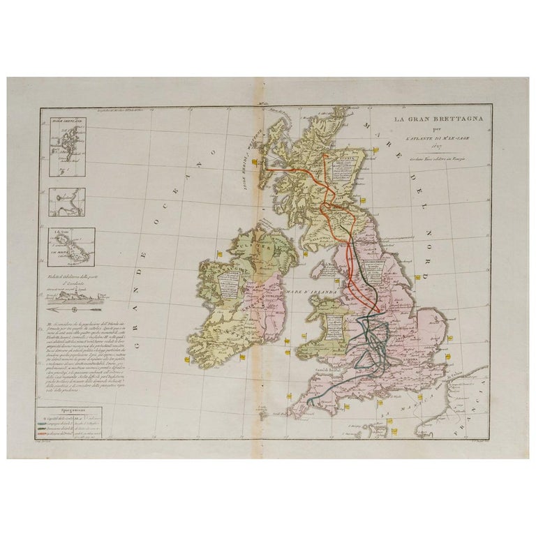
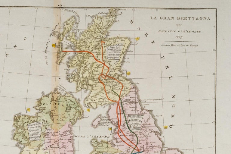
Antique 19th-century map of England - ST/520 -
Codice:
294581
400
Aggiungi ai preferiti
Period:
Early 19th century
Category:
19th Century Prints
Dealer
Enrica Pasino
View all dealer's items
Via 24 Maggio, 1, Alessandria (AL (Alessandria)), Italia
+39 0131.264011
https://www.facebook.com/enrica.pasino
Antique 19th-century map of England - ST/520 -
Description:
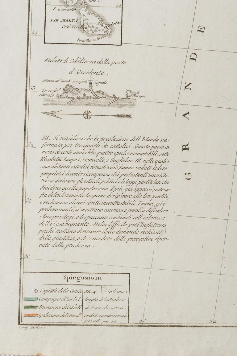
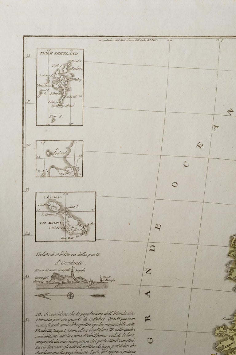
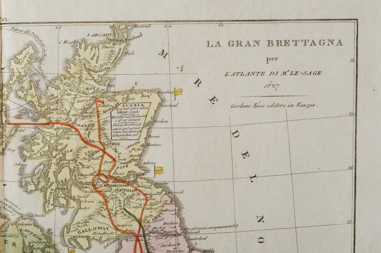
Antique Italian map dated 1827 "Great Britain" for the Atlas of M.r Le-Sage; author Girolamo Tasso, publisher in Venice. measures cm. 54 x 40.
Facebook
X
Pinterest
WhatsApp
Copia Link
🍪